The cone-shaped hill on which the village is located, hugging the southern flank of a steep sandstone formation, captures the gaze.
Their houses tell the story of traditional Somontano architecture, with large stone voussoir façades, like Casa Luesia, with its coat of arms and ancient legends.
Its points of interest include the impressive remains of an ancient medieval fortification, the Renaissance-style Parish Church of San Bartolomé, the Chapel of Santa Bárbara, and the well/fountain, likely built before the Muslim domination of the region.
Velillas is also home to a number of natural and cultural landmarks as part of the “Piedras Fecundantes (Fertility Rocks) Route”, sandstone formations attributed to ancient pagan fertility rites; here visitors can see what has been named “piedra mujer (woman stone)”.
Its location is certainly original, since both its historic center and church and the remains of the castle sit on a sandstone ledge, with several enclosures carved from the rock.
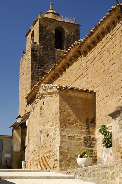
Its Romanesque Parish Church of San Juan was renovated in later years. The cemetery, located adjacent to the church, provides the best views of Hoya de Huesca from this perspective.
King Peter I of Aragón confirmed that village belonged to the Monteragón Castle and Abbey in 1099. Today it belongs to the municipality of Angüés.
A number of natural and cultural landmarks are nearby: the “piedras fecundantes (fertility rocks)”, sandstone formations attributed to ancient pagan fertility rites, and the village’s old lime kiln.
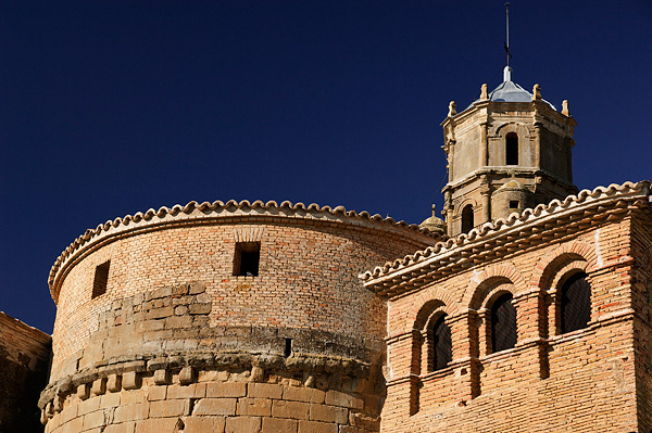
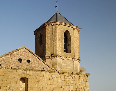
The first glance visitors have of the village is the slender tower in the distance, topped by its characteristic conjuratory.
The village's entire historic quarter is centered around the Church of the Purificación de Nuestra Señora, which has Romasque beginnings paired with all the splendor of the Aragonese Baroque in its general structure and aesthetics.
Angüés has managed to preserve outstanding examples of traditional civil architecture in the Guara foothills, with lintels carved in stone in the 17th century.
Visitors can take the old Casbas trail on the outskirts of the village to the well/fountain, traces of the village's Moorish past. This is a cistern dug into the ground, with four vaulted chambers with dressed stone and a long stairway for access.
The village is located halfway along the Somontano Altoaragonés road, the former Camino Real (Royal Road); the village was reconquered from Moorish rule in 1093 by Sancho Ramirez, and later belonged to the manor of the Montearagón Monastery, and has been documented as a village since the late 11th century.
Angüés serves as a point of entry to the Sierra and Canyons de Guara Natural Park to the north, with nearby natural attractions including the Formiga ravine, the Calcón reservoir and the Tozal de Guara, at 2,078 m the tallest peak in the Pre-Pyrenees.
Another interesting option combines natural and cultural landmarks on the "Piedras Fecundantes (Fertility Rocks) Route", featuring fascinating openings carved into large sandstone rocks that are attributed to ancient pagan fertility rites. These formations are found near the municipality's three villages: Piedra Mujer (Rock Woman) in Angüés; Piedra Fecundante (Fertility Rock) in Bespén and Piedra Mujer (Rock Woman) in Velillas.
Angüés celebrates its annual festivals on February 3rd in honor of St. Blaise, as well as on the first Sunday in October in honor of Our Lady of the Rosary.